
Winter Rain in Greenland Is Another Bad Sign
Rainfall in Greenland turns the ice gray, which increases heat absorption.
More bad news from Greenland last week. It was raining. In the winter.
In case there is any doubt, rain in the winter time, above the Arctic Circle is not at all normal. Most might even say, “it is not supposed to happen.” This time of year, any precipitation in the high north, should be in the form of snow. As most of us have seen, rain can quickly melt down through snow and cut into ice. Even very cold water has a lot of melting power. Of course, the warmer the temperature, the greater the effect.
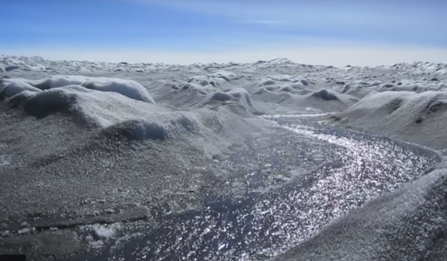
 In addition to melting and eroding the snow and ice, there is another effect that was not well recognized until now. As you may be able to observe in the photo above, after rain, the ice becomes a shade of gray. Though it may seem subtle, it does not reflect sunlight nearly as well as the white snow as shown in the photo at right, from one of our expeditions on top of the mile-thick Greenland ice sheet. Perhaps using the color of a roof or car as an example, bright white reflects the most light and heat energy, not quite a 100% but it can be in the 90’s. On the other hand, a pure black matte surface absorbs almost 100% of the incoming radiant energy and is much hotter than a white surface.
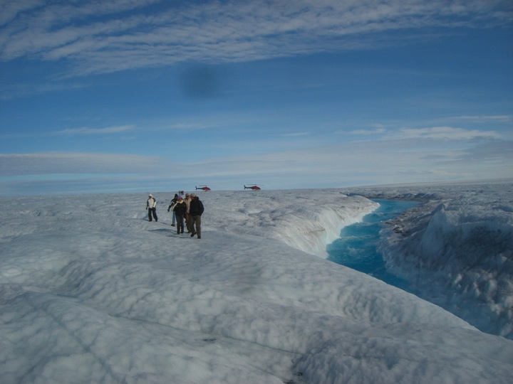
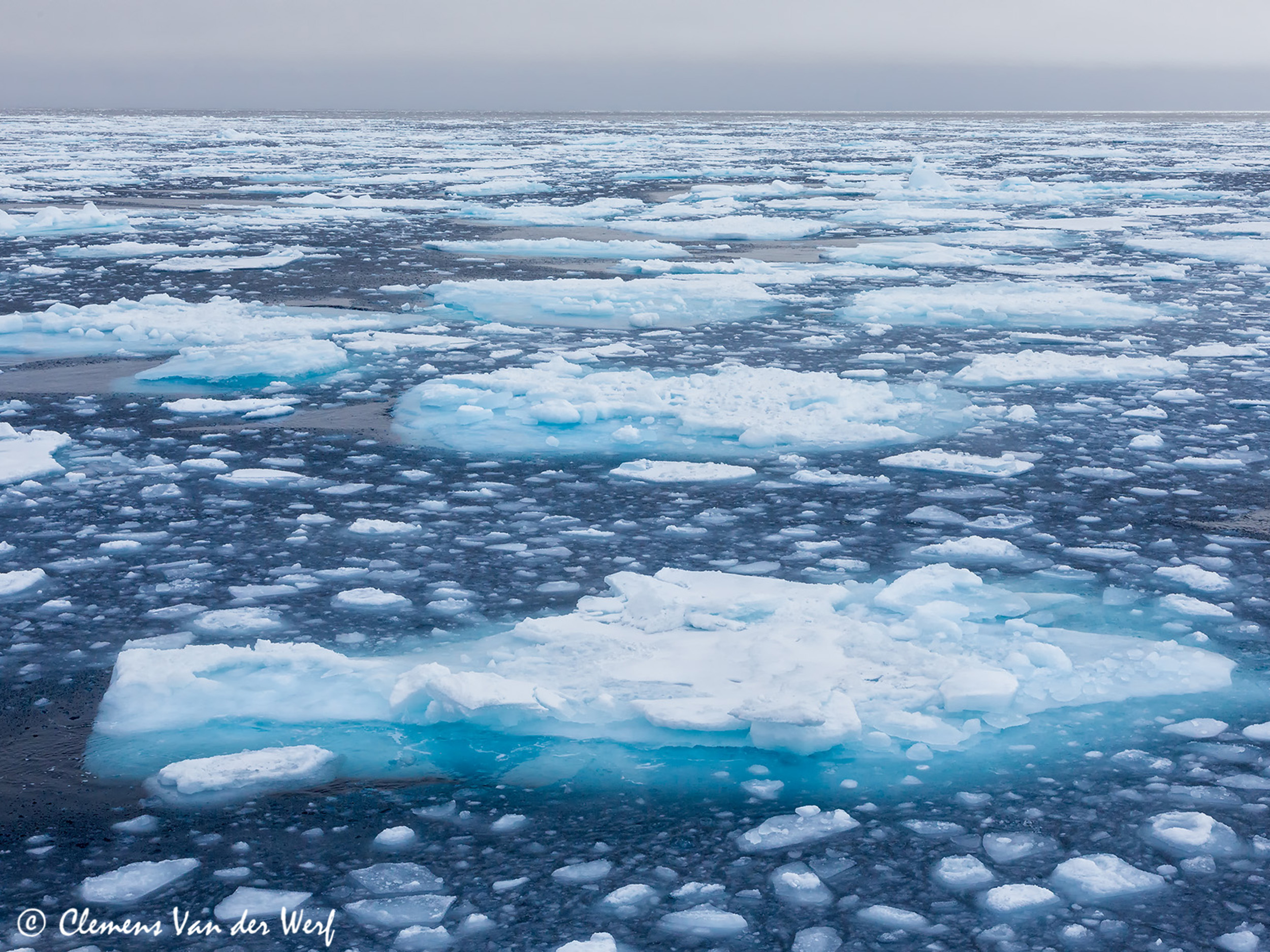
Melting Arctic Ocean turns from white to very dark blue. (Photo: Clemens Van Der Werf)
That’s why the melting of the Arctic Ocean is accelerating the planetary warming as the vast area around the North Pole goes from bright white to very dark blue ocean as shown in the photo at left. Earth is absorbing more heat, which in turn melts more ice, which increases the temperature level; what we call a “feedback loop.”
Also the warming ocean evaporates more water into moisture. With warmer temperature, that comes down as more rain. Now, even as rain in the high Arctic in the wintertime. The very gray color in the top picture shows us a new reason why the warming and melting are getting ahead of projections. This rain in Greenland in the winter was not in most of the climate models.
It is a good example that there are new phenomena in this rapidly warming world. The melting ice, changing ocean and atmospheric currents, and the rate of rising sea level continue to accelerate and even to surprise us.
Rainfall and ponding water are highly destructive for glaciers for many reasons:
- Water carries a lot of heat energy, which directly speeds melting.
- Any water on top of the ice sheet, finds pathways to move downward, gathering in larger and larger streams.
- When the water does freeze, it expands, fracturing the ice.
It may seem to some of my readers that I am overly concerned about Greenland. I think not. The fact that it holds enough ice to raise global sea level more than twenty feet (7 meters) means that its rate of melting will determine coastlines all over the world in the coming decades. What is happening there now is truly ahead of projections.
A week ago in this space, I wrote about a special trip to Greenland “Why Go To Greenland“. [CLICK for information, video, and brochure.] Yet, these new reports later in the week about rain in Greenland during winter even surprised me. It underscores the case that what is happening throughout the Arctic is stunning even to the experts. Those of us that have been to Greenland find it more than educational. It changes one’s view of the world. The ice sheets, glaciers, and icebergs also have special beauty and power. The news stories the other day about rainfall in Greenland were a reminder of how it is changing quickly. What normally occurred over centuries and millennia, is now changing in years and decades.