
U.S. Flood Risk Tool Is Now Super Easy
 Flood risk seems to be on people’s minds everywhere. All over the world there is record flooding from:
- hurricanes and coastal storm surge
- heavy rainfall and runoff
- inland rivers overflowing their banks and levee failures
- King Tides and rising sea level
Information is handled differently in different countries. Even in the United States, the different maps and methodologies to understand your potential flood risk can be bewildering. Generally it’s been complicated, something best left to professionals.
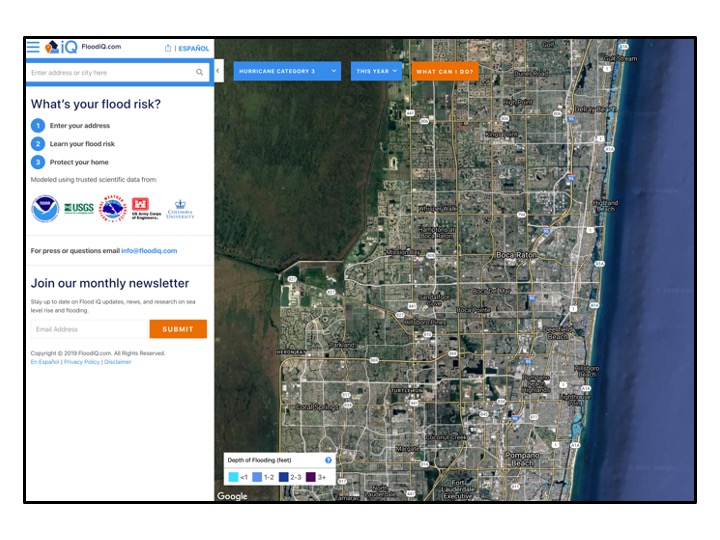
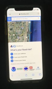 For those in the U.S. I am pleased to say there is now a product that makes it extremely simple. Even better it’s a free service. Check out the web-based FloodiQ.com, http://www.floodiq.com It works well on computers, tablets and phones.
You just enter a street address. It produces a flood rating and offers a free 8 page report.
Kudos to the development team. www.floodiQ.com
Those needing a comparable tool for international addresses should have a look at Surging Seas from Climate Central, also very user friendly.