
Year-Old New Orleans “Levee Fix” Forecast to Fail
One of the world’s iconic cities, New Orleans, is famous for jazz, Mardi Gras, – and flooding. Rated the most hurricane vulnerable city in America, “Katrina” in 2005 was its most deadly and catastrophic. As a result, the U.S. government committed to fully upgrade the flood defenses for this special city at the mouth of the Mississippi. That’s why this headline in SCIENTIFIC AMERICAN Magazine last week caught my attention:
“After a $14-Billion Upgrade, New Orleans’ Levees Are Sinking – sea level rise and ground subsidence will render the flood barriers inadequate in just four years”
What?…To quote the first two paragraphs: “The $14 billion network of levees and floodwalls that was built to protect greater New Orleans after Hurricane Katrina was a seemingly invincible bulwark against flooding. But now, 11 months after the Army Corps of Engineers completed one of the largest public works projects in world history, the agency says the system will stop providing adequate protection in as little as four years because of rising sea levels and shrinking levees.”
This was a story I had to follow to the source to make sure there was no misunderstanding. The Scientific American version led to E&E News, with a story by Thomas Frank, and cited an announcement in the Federal Register. There in the sterile and dense listings for April 2nd, on page 12598 in remarkably clear and succinct language, the U.S. Army Corps of Engineers (“USACE”) indeed announced that it was doing a full re-evaluation of the just-completed project to determine if protecting New Orleans from a “hundred year storm” was even technically possible and economically justified – a stunning statement, by itself.
It should be noted that once in a hundred year events are happening much more frequently all over the world, even every two or three years, in some cases.
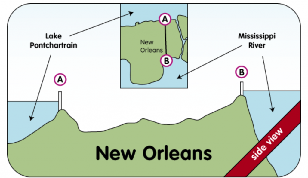
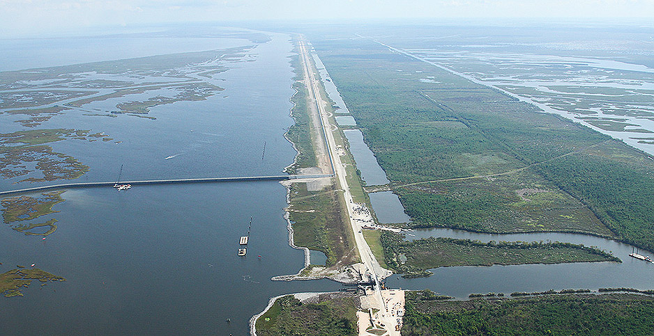
As illustrated in this simple cross section graphic, present-day New Orleans is entirely dependent on earthen levees, concrete flood walls, and pumps to keep the water at bay on both the river side and Lake Pontchartrain.
Rising Seas and Shrinking Levees
In the Federal Register, they cited that sea level is rising even faster than they calculated back in 2007 when they did the design and engineering. Partly that’s from the rate of melting polar ice, but in that area, at present, it’s more due to the land subsidence. The land is compacting––a normal situation where rivers outflow, in their fan-shaped delta areas, due to all the soft sediment and silt that comes down a river over thousands of years.
Not only do the compacting sediments and land subsidence effectively increase sea level in that region, the foundation of the levees moves lower; some of the aged levees even have internal compaction. This accounts for the “shrinking levees”, the other cause cited with rising sea levels.
The Mississippi River is the largest river system in the U.S. The vast drainage basin and river network were generally created about five thousand years ago, as the last glacial ice sheets melted on North America and sea level reached the present height. The mouth or delta of large rivers like the Mississippi, typically exhibit “delta switching” about every thousand years, as a result of sediment pile up, causing the river to find another path to the sea. But since we like rivers to stay in one location to suit our needs and commerce, we work to tame the river, to keep the river in its place.
That’s the purpose of most of the USACE’s work over the last century. It is no surprise that we try to engineer and build infrastructure to confine and redirect the forces of nature. Largely that is what human ingenuity has enabled, allowing our society to flourish. Rising sea level, due to the melting polar ice sheets, is raising the problem of flooding to a whole new level. It will only get worse.
At some point we need to start taking the long view and ask where things are headed. How long can we keep the particularly vulnerable coastal cities where they have been for recent centuries. New Orleans and this expensive investment should give us pause to consider that we really are in a new era.
There is no way we can keep coastal communities in their current configuration and location forever. While New Orleans seems special, the fact that it’s sinking faster than any location in America, may make it the place where we have to confront the mature decisions of intelligent adaptation, including options of retreat, or total redesign and rebuild.
In my presentations and consulting work, I usually recommend looking ahead thirty years. That gets us to mid-century. It’s a mortgage period or “building cycle.” Sea level rise projections for mid-century are now for as much as a foot or two––depending on how warm the planet gets and exactly how certain glaciers in Antarctica collapse. The rising sea level, combined with heavier rainfall, with the resulting far greater runoff, and with extraordinary storm patterns, all make clear that we have passed a tipping point. Weather patterns and sea level are in new territory.
Presently global average sea level is rising only at about two-tenths of an inch a year (5 mm). However, because the land at the Mississippi delta is sinking, the effective rate of sea level rise in the New Orleans area is far greater. But as I explained in a post last month, by mid-century, we will start to see the effects of exponential increases in sea level rise, with the rate perhaps doubling every decade.
New Orleans is not alone. Other U.S. areas with particular vulnerability include the region around Norfolk, Virginia – also due to abnormal subsidence, and Sacramento, California – due to flawed levees. As depicted below, there are over 29,000 miles of levees in the U.S. with an average age of 55 years that did not anticipate sea level rise nor extreme rainfall. Already many of the levees are on the verge of failure; more will be in the coming decades. (In a future post, I will illustrate some of the international sites of high vulnerability.)

The important lesson from the stunning revelation about New Orleans problem, is that it’s time to begin planning for this global challenge. Hoping or pretending that sea level will not rise is irresponsible. The longer we avoid facing reality, the more expensive it will ultimately be in assets that are underwater, and likely in lost lives, as well.
The tough planning decisions that need to be confronted in the city known as “the big easy” will be anything but. The real benefit of this $14 billion dollar project might be that it awakens all of us, to the folly of short-sighted planning in a period of ever-greater flooding from multiple forces.