
New FEMA National Risk Index Ignores Rising Seas
New FEMA National Risk Index released November 2020
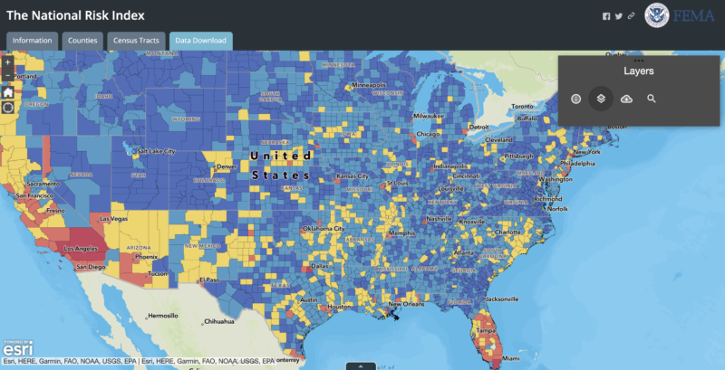
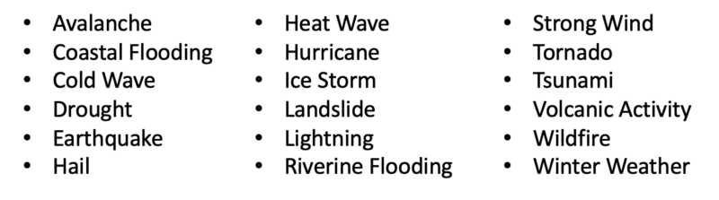
The U.S. government’s new National Risk Index was released on November 20. The good news is that it ‘s very user friendly. Clearly a lot of time and effort was put into this project. FEMA – the Federal Emergency Management Agency– has come up with a composite risk score, covering 18 separate risks, mapped at the county level. As shown on the master map above, blue is better; red equals risk. The risks are:
My special area of interest, rising sea level is not listed, but coastal flooding is. Since extreme sea level rise cannot happen quickly, it is understandable and perhaps reasonable that the rising seas are not explicitly included in the list of eighteen risks. Yet as my readers know, the risk of rising sea level is particularly insidious. Like a drip filling a bucket, it’s slow, stealthy, but unrelenting. Also, it adds to the risks of coastal and riverine flooding. Even early stage sea level rise has been shown to severely impact the values of vulnerable coastal properties.
Looking at the map even briefly, the first thing that catches my eye is Jacksonville Florida, on the Atlantic coast just below Georgia. Seeing that Jacksonville is ‘blue’ should that indicate the region is on the other end of the risk scale from Miami, shown in red. That’s dubious. Jacksonville is the second largest city in the US by land area and the largest population city in Florida. (Other places like Miami/Dade, and Tampa have larger population but not in a single city.) Jacksonville is a low-lying delta area at the confluence of the St Johns and Matanzas rivers. It’s extremely prone to flooding, most recently in September 2018 when Hurricane Irma flooded the city for weeks, the latest of many major hits, such as Matthew, Beryl, etc.
As I look further on the map, other things cause me to want to dig deeper, which I will do…when time allows. But fundamentally I find myself questioning the concept of having a simplistic index of highly diverse risks. There may be some merit in coming up with a composite score, but I am rather suspect. It may be another case of more data, less information, and little comprehension.
I will leave it to readers to decide if it’s useful. The link is: https://www.fema.gov/flood-maps/products-tools/national-risk-index If you find the new National Risk Index useful – or not – perhaps share in a comment here.