
The Real Mission of that New Sea-Level Satellite
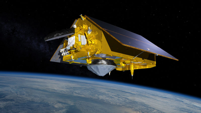
Satellite Sentinel-6 Michael Freillich launched 11-21-20
Last Saturday NASA launched Sentinel- 6 Michael Freilich, a new satellite to measure sea level. (The name pays homage to a leading program advocate for Earth science at NASA who died this year.) Media reports suggested that a satellite focused on sea level was a bold new advance; some claimed it “might help California adapt to a changing coastline.” I agree that the satellite is extremely important, but not at all for those reasons.
In fact, precise measurements of global sea level by satellite started in 1992, with “Topex” eventually succeeded by the Jason series. Satellites have limits to useful life, often just four to six years. Sentinel-6 has some modest improvements, but primarily it replaces aging predecessors. It will extend the monitoring program with continuity. The value is the consistency of the method in order to get precision over a longer period of time, particularly since we are measuring global sea level to fractions of a millimeter. In fact, the next satellite is already planned to launch five years from now to maintain mission continuity.
As shown in this NASA compilation of satellite sea level data, what is so alarming, is the trend. Not only is sea level rising, the rate is rapidly increasing.
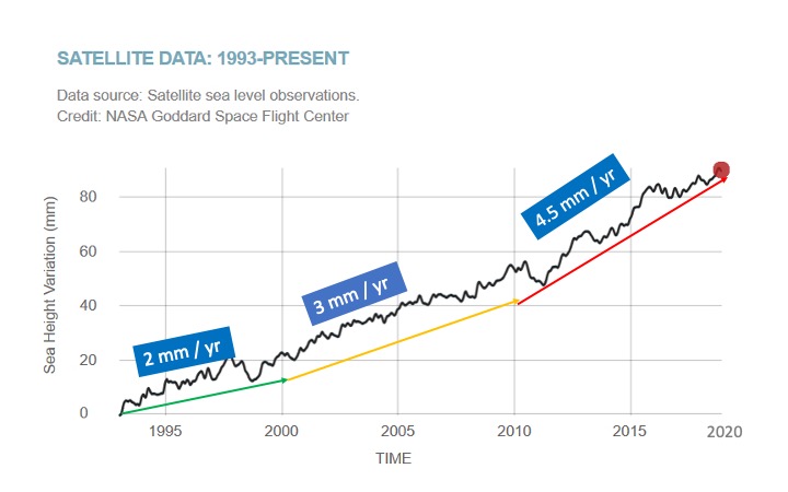
In the 1990’s the satellite data showed global sea level was rising about 2 mm a year – less than a tenth of an inch. As shown, in the first decade of this century (the 2000’s) the rate increased to over 3 mm a year, a 50% increase. In the most recent decade, the rate is 4.5 mm a year – about a sixth of an inch, another 50% increase in a decade.
Even if the rate of sea level rise (SLR) continued to increase just at 50% a decade, by the end of this century, global sea level would be rising at more than a foot (30 cm) each decade – a rate that would be devastating for all coastal cities and countries.
The rate of melting ice and rising seas will keep accelerating on a planet that keeps warming. The big question is, how fast will the rate of SLR increase? Surprisingly, the future rate cannot be precisely predicted due to the complexities of the enormous two ice sheets on Antartica and Greenland. History shows the rate of sea level is not smooth; it can change suddenly. The extreme scenario is exponential growth, a phenomenon I described in a blog post last year, “How long to fill a soccer stadium with water?”
Satellites like Sentinel-6 –– and its replacement five years from now –– are the key measuring tool to monitor what is happening. All eyes on “Michael Freilich.”