
As Greenland Melts, International Cooperation or Conflict?
Cooperation or Conflict? As Greenland Melts – Part 4 of my series (finally)
With the melting of the polar ice cap — the floating sea ice in the vicinity of the North Pole — EVERYTHING changes. A list of top level long-term impacts includes:
- World Weather patterns.
- Shipping Routes.
- Exploration for minerals in the region.
- Resident communities, some new, some abandoned
- Definitions of territory – sovereignty
- Potential for shipping accidents, possibly involving cargo, oil, or tourism
- Tensions and cooperation between the eight Arctic nations as well as all the other nations like China shipping goods through the area
It has now been a month since my visit to Greenland. As described in the first three parts “Greenland is getter Greener” (part 1) the change on that Arctic Island is unmistakable. The impacts are just starting but range from even MORE icebergs at the same time that the melting ice beckons more shipping and cruise ships, to accelerating sea level rise, to changes in global weather patterns — even including the abnormal torrential rainfall that is becoming normal.
The fourth broad topic became clearer to me while I was there, the international implications. And they are profound. I would define them as:
- Sovereignty — the exact boundary lines between nations.
- Fisheries and Mineral resources in the region – two rather distinct areas
- Regulatory Enforcement and Rescue Capability in a harsh remote region
- High potential for international conflict, due to tight confines and “choke points.”
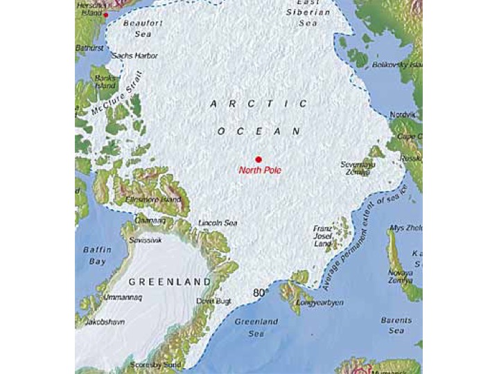
Not only is the Arctic physically distant from most people, there is a peculiar reason that we have trouble grasping the delicacy and ambiguity in the region. In many ways, the problem is maps. Most maps flatten out the world, greatly expanding sizes and apparent distances of everything at high latitudes, near the poles. In fact the opposite is true. Everything at the North Pole comes together — distances are relatively tiny. (BTW, this issue of overlapping territories is in stark contrast to Antarctica, mostly one over-sized island, that by treaty belongs to no nation.
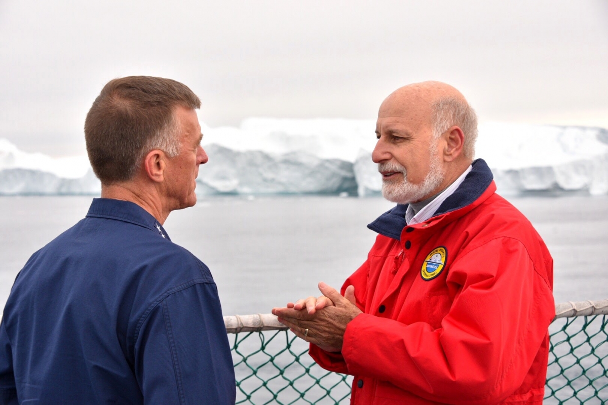
As we planned the trip, the 3 focal areas to me were the opening up of sea routes, accompanied by more icebergs; to see what is happening with the ice sheet and glaciers that will result in global sea level rise; and to get a sense of how the melting of the floating ice shield is just beginning to change global weather patterns. The issue of international cooperation and potential conflicts was something new to me, but one that was clearly on the minds of Senator Angus King, US Coast Guard Commandant, ADM Paul Zukunft, and his Danish counterpart, Major General Kiim Jørgensen who was our host from the Joint Arctic Command based in the Greenland capital of Nuuk.
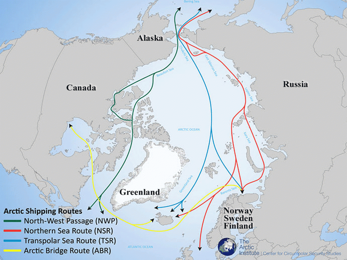
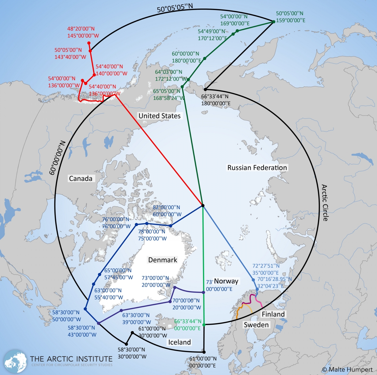
If we consider the new shipping routes that are opening up, and the jurisdictions agreed by the various Arctic nations the complexity and potential for disputes becomes quite clear. Look at these less-distorting polar-perspective maps of shipping routes, Coast Guard zones, and sovereign boundaries.
Greenland. Russia is in the process of construction numerous new ports
on its Arctic border to facilitate shipping and exploration.
the most dangerous maritime environment in the world. This map
depicts how the various countries have organized search and rescue zones.
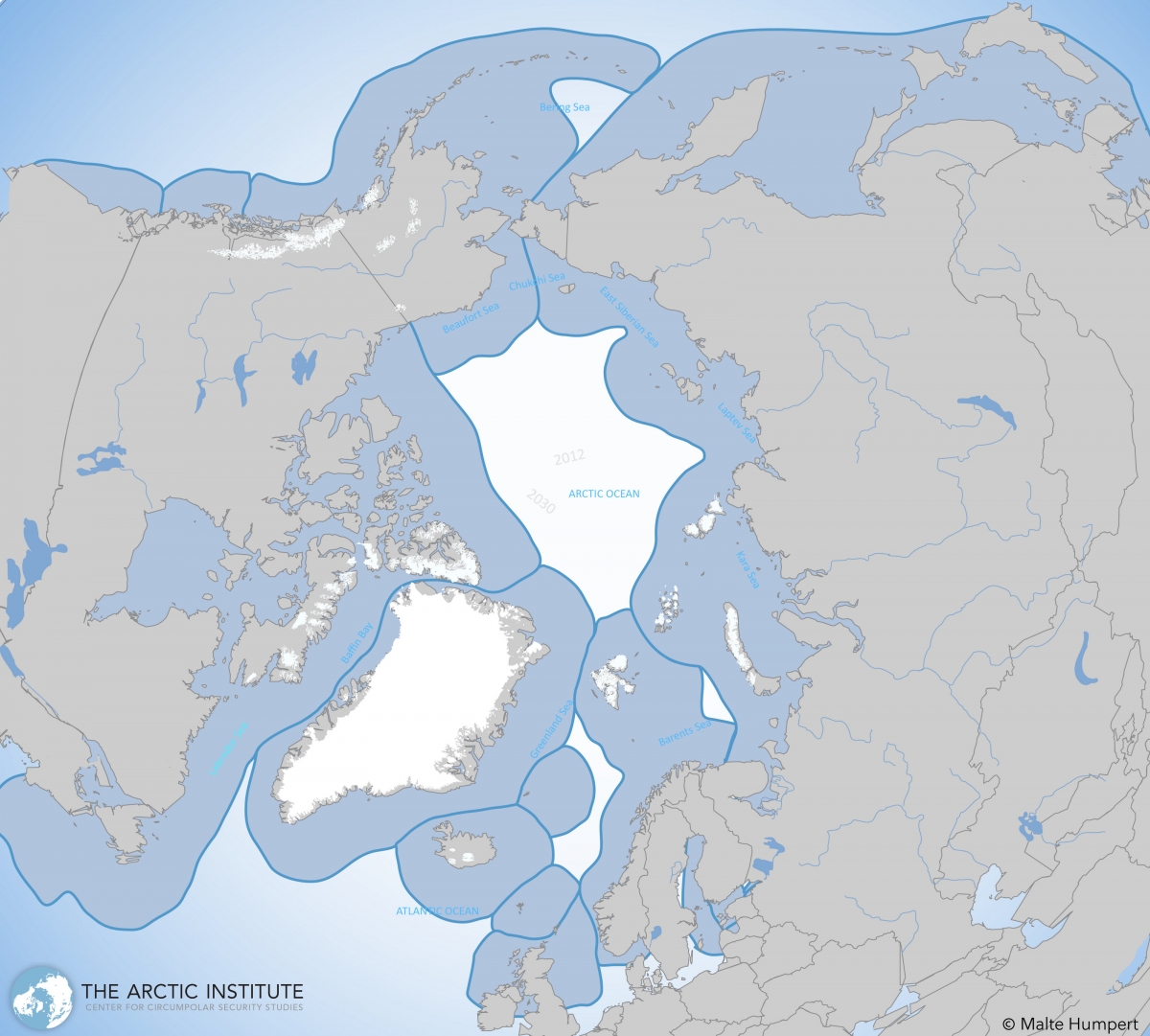
of sovereignty as shown om this diagram. National territories include:
USA, Canada, Greenland / Denmark, Iceland, Norway, Sweden, Finland, and Russia.
Russia and other nations are looking for new topographic data that might alter the boundary lines.
The rules for determining sovereign and economic boundaries for nations are very nuanced and complex, but the importance is clear. As a result of the melting of the polar ice cap, there is new access for shipping, exploration, and even better mapping of the sea bottom, what is called bathymetry. For example Russia is doing considerable work to find areas of sea bottom that might justify drawing the lines of national boundary differently. The stakes are high.
In addition to commercial shipping and now cruise ships there are also huge interests to explore for petroleum and other minerals. In fact it turns out that Greenland has the precious rare earth minerals in abundance, apparently a supply second only to Asia. Chinese interests are already there working to extract them.
The planet is changing in profound ways. The Arctic may be the area that is most complicated, yet only on the ‘radar screens’ of a relatively few people. Understandably the US Coast Guard is one of the agencies keeping a watchful eye and planning ahead. It is consistent with their motto, semper paratus, meaning always ready.
For additional photos from the Greenland visit, with more icebergs and glaciers, see my Facebook page.
Also see article today in Huffington Post by Peter Emerson, “Cruise Ships and Icebergs Should Not Mix; The Arctic is Not Ice-Free”.