
New Map of What’s Under Greenland’s Ice Shows How Bad Sea Level Rises Could Get – Science Alert
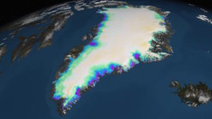 Article synopsis – Scientists just published a map of what lies beneath the Greenland ice sheet, the most accurate and comprehensive chart of this terrain yet, and it’s going to be crucial in making calculations about potential sea level rise in the future. The map has revealed that some glaciers are thicker than previously thought, raising Greenland’s contribution to sea level rise from 20 feet (6 meters) to 24 feet (7.42 meters). The researchers will continue to update the map as more data is gathered. To read the actual article click here.