“Jonas” illustrates dark magic of Storms, Tides, and Sea Level Rise

‘Jonas’ (also known as: the Blizzard of 2016, and “snowzilla”) was just one more unusual weather event that will go down in the ‘record books.’ What made this special was how the amount of moisture in the air and the unusual temperatures and pressure patterns aligned for the massive snow. Yet, heavy snow does not cause coastal flooding.
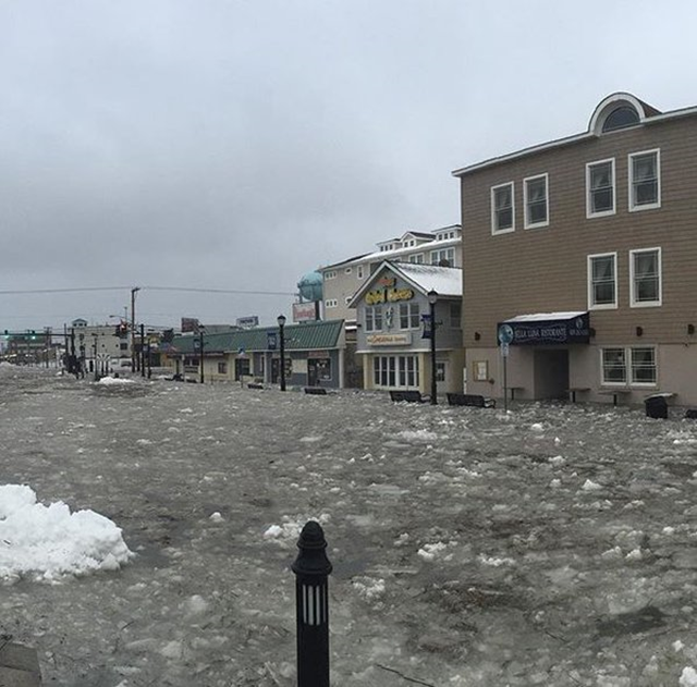
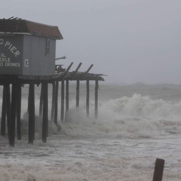
The severe coastal flooding from the Carolinas up to Massachusetts illustrates the dark magic when flooding forces combine. Jonas was not even hurricane force winds, something we associate with severe coastal damage. There were strong winds, but by themselves they would not create this kind of coastal flooding.
But Jonas did hit at the full moon, when tides are more extreme. Plus we are in the higher phase of the 18.6 year tide cycle, raising water heights even higher this year. (Most are unaware of this 18.6 year long tide cycle with powerful effect. It is worth a separate blog post, which I plan to do in the next two weeks. Sign up for blog notifications if you want to receive it automatically.)
It is the invisible way that the timing of the wave heights and the tide cycle just happen to hit that determines whether flooding will be really bad or not. This weekend for example, when Jonas hit Annapolis, the tide was not at the high point, so the damage was not too bad. When the peak of the storm hit farther up the coast the damage was much worse, because it hit at high tide.
Over the last century sea level in the area of the mid Atlantic east coast of the United States has risen approximately 14 inches. That will not reverse for at least a thousand years, until such time as the planet’s temperature has fallen to the point where the glaciers and ice sheets return to growth mode. Actually the rate of sea level rise is now increasing dramatically. (The “doubling time” — the period for the rate to double — was about thirty years; now it appears to be less than twenty years.)
In fact our problem with sea level rise is almost entirely related to the rate of the rise. Eventually sea level will be tens of feet higher than now. The question is how quickly. That depends on the amount of heat we add to the oceans and some subtle structural dynamics in Antarctica that cannot yet be determined.
And of course sea level just keeps inching higher and higher, as the glaciers and ice sheets in the polar regions continue to melt from record levels of heat. (Arctic temperatures this month were 50 degrees F above normal.)
I like to use the rhyming phrase “storms, tides, and sea level rise” to help identify how this powerful synergy between those three forces that will keep breaking records over the coming decades. When we see streets flooding there is a tendency to think of it as having a single cause.
Yet the fact is that there can be various factors that contribute to flooding:
- heavy rainfall
- storm surge — a bulge in ocean height driven by wind or low barometric pressure
- different levels of ‘high tide’ which cycles primarily due to the position of the planets, peaking almost twice daily, with extra height at the full and new moon according to the 28 lunar cycle.
- sea level — the base ocean level at low tide that primarily reflects the amount of ice on land and any overall change in ocean heat content. On a regional level, sea level can also be affected by land subsidence, a drop in its elevation due to compaction, plate tectonics, extraction of groundwater or petroleum.
Erosion is a different phenomenon, though it often also gets lumped in with these types of flooding. Primarily erosion at the beach is due to direct wave action driven by local or distant storms, OR is due to the long term removal of sand by the normal currents along the coast, but often disturbed by artificial structures like jetties, inlets, and groins that interrupt the natural movement of particles, making beaches narrower in one places, and wider in others. To a considerable degree, what we think of as erosion is a natural inevitable process as ocean currents continue to sculpt shorelines in a very dynamic manner.

The flooding this weekend from Jonas is a powerful reminder how storms, extreme tides, and sea level rise are a swirling dynamic. What we see is the severe flooding. Almost everyone associates the flooding with the record storm. They do not notice how much the subtle planet driven tide cycle contributes. It is also easy to overlook how the unstoppable long term rising sea will keep making these events worse and worse.
The sooner we plan and adapt to rising sea level, the better communities will be prepared for these short-lived storm driven flood events too. Some call it resiliency. Whatever we call it, planning for higher ocean levels is a good investment for coastal interests everywhere. That is the business case we make at The Rising Seas Group. Planning ahead for inevitable higher sea level is a good investment. Any sailor knows that you look out to the horizon to know the weather that is headed your way. We can plan and adapt to higher sea level that is now on the horizon. Indeed we must. I like to use an approach called the “9-box matrix” which allows different stakeholder groups to look at their own Short-Medium-Long time perspectives, against Low-Moderate-Worst case projections for sea level rise for a particular geographic area. With that and a vulnerability assessment, the next step is to plan adaptation.
Events like Jonas should remind everyone with coastal interests that even modest storm surge can have surprising impact. We are at the early phase of a very long term trend, an ever-rising sea level — something not witnessed in human history. We can ADAPT. To do that we must PLAN. To do that, we must UNDERSTAND where things are headed.
