
NASA’s Operation IceBridge Is Monitoring Ice Loss in Canada and Greenland – Gizmodo
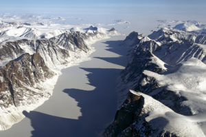 Article Synopsis – NASA has launched Operation IceBridge, a six year study involving research flights over Canada and Greenland in order to craft a 3D model of the area. The aircraft used in Operation IceBridge are fitted with special equipment designed to monitor, map and document the ice levels below, including laser altimeters to measure ice elevation, radars which measure ice depth, and gravimeters and magnetometers which are able to measure the depths that radar can’t manage. To read the actual article click here.